
Monitoring mine reclamation: satellite, geo-tagging and reporting

Mine reclamation is now checked from the sky. CMPDI maps reclaimed and planted land in coal mines from satellite data. The Mineral Conservation and Development Rules ask non-coal leases for yearly drone or satellite images by 1 July. Companies need ground records that match: geo-tagged trees, survival counts and fixed-point photos.
A mining company can plant thousands of saplings and still fail a review. Usually the problem is not the trees but the records.
This guide explains what regulators already see from above, what ground data you need, and how to turn it into closure and BRSR reports.
What do regulators already monitor?
Coal mines: CMPDI satellite monitoring
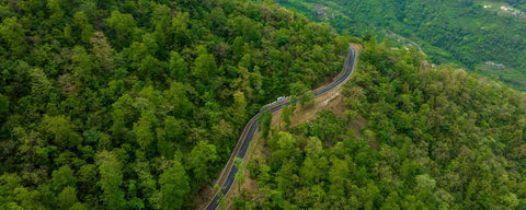
The Ministry of Coal says satellite-based monitoring tracks progressive reclamation across coalfields. CMPDI's Remote Sensing Cell prepares the reports.
One CMPDI report covers five clusters of coal mines, using 2021 satellite data. It maps backfill, plantation, social forestry, active mining, water bodies, wasteland, farmland and forest.
It separates technical reclamation (barren backfill) from biological reclamation (plantation on backfill). In that report, 5.08% of the excavated area was planted on backfill, while 58.52% was backfilled but still barren.
That gap is common. Backfill without vegetation is not yet reclaimed land.
Coal mines: closure portal
CMPDI has also built a portal to monitor closure activities, including reclamation, post-closure air and water quality, and land repurposing (PIB, January 2024).
Non-coal mines: MCDR drone and satellite images
Rule 34A of the Mineral Conservation and Development Rules, 2017 applies to non-coal major minerals. Larger leases must fly a drone survey every April or May.
Larger means an annual excavation plan of one million tonnes or more, or a lease of 50 hectares or more.
They submit a digital elevation model and orthomosaic to the Indian Bureau of Mines by 1 July. Smaller leases submit high-resolution, geo-referenced satellite images taken from April to June.
Rule 35 adds a star-rating self-assessment, also due by 1 July, along with these images.
What ground data do you need?
Satellites see canopy and land cover. They cannot tell a living sapling from a dead one under grass, or name the species. Ground records fill that gap.
| Layer | What it shows | How often |
|---|---|---|
| Geo-tagged planting record | Each sapling's location, species, date and block | At planting |
| Survival count | Live versus dead plants in each block, with replacement | Every year for three years, then periodic |
| Fixed-point photos | The same view, season after season | Each season |
| Drone orthomosaic | Canopy spread, gaps, erosion gullies on dumps | Yearly (often already required) |
| Satellite imagery | Green cover change across the lease | Yearly or per review cycle |
| Soil and water tests | Organic matter, pH, run-off quality where the plan asks | As set in the closure plan |
How do the reports fit together?
- Coal mine closure: a yearly report to the Coal Controller before 1 July, and five-yearly reviews linked to escrow release. See our coal mine closure guide.
- Non-coal mine closure: a yearly report under MCDR Rule 26 before 1 July, with the annual return. See our MCDR closure guide.
- BRSR: listed companies disclose land, biodiversity and restoration in Principle 6; see where plantation goes in BRSR.
- CSR: board reports and impact assessments need tree counts that hold up.
One dataset should feed all four. If the drone map, the closure report and the BRSR figure disagree, reviewers notice.
What makes monitoring credible?
- Report trees alive, not saplings planted.
- Use the same block boundaries in every report.
- Keep raw data, including dead plants and replacements, not only summaries.
- Label any carbon figures as estimates, and never use them to claim a cut in your plant's emission intensity.
- Let a third party sample-check survival in some years.
How Grow Billion Trees helps
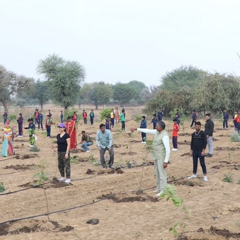
GreenTrack holds geo-tagged records for every tree we plant, with yearly survival counts and photos. We report 85% survival across our programmes using the method on our survival methodology page, and export summaries for closure reports and BRSR. See the coal and metal mining hubs.
Further reading: Mine reclamation under MCDR: progressive mine closure plans · Limestone Quarry and Mine Reclamation for Cement Companies
Frequently Asked Questions
Does CMPDI monitor reclamation from satellite data?
Yes. CMPDI's Remote Sensing Cell maps backfilled, planted and active mining areas in coal mine leaseholds from satellite data.
What is the difference between technical and biological reclamation?
In CMPDI's reports, technical reclamation is barren backfill. Biological reclamation is backfill that has been planted.
Do non-coal mines have to submit drone images?
Yes, if they are large. Under MCDR Rule 34A, leases planning one million tonnes a year or more, or of 50 hectares or more, submit drone outputs by 1 July.
Is geo-tagging each tree really needed?
It is the easiest way to prove survival block by block. Satellite images show canopy but not individual live plants or species.
Can the same data serve closure, CSR and BRSR reports?
Yes, and it should. One consistent dataset avoids contradictions between reports.
Can we report carbon from reclamation plantations?
Only as estimates in voluntary reporting. Trees do not reduce a plant's emission intensity under India's carbon market. See our CCTS guide.
Sources: Ministry of Coal: Greening initiatives · CMPDI: Land reclamation monitoring of coal mine clusters on 2021 satellite data · PIB: Coal Ministry mine closure strategies (12 Jan 2024) · Indian Bureau of Mines: Mineral Conservation and Development Rules, 2017 (amended to April 2025) · Ministry of Coal: Guidelines for preparation of mine closure plan (7 Jan 2013). Last updated: October 2026. Rules change; check the latest notification before you rely on any detail.




Leave a comment