How Does Geo-Tagging Work in Plantations? A Complete Guide
Geo-tagging in plantations uses GPS coordinates to record the exact location of each planted tree, creating a verifiable digital record at the moment of planting. This technology links every tree to a unique digital profile, making it easy to monitor growth and confirm survival over time. As a result, geo-tagging transforms tree planting into a transparent, accountable, and deeply meaningful act for donors, corporates, and communities alike.
In 2026, reforestation efforts are more data-driven and impactful than ever before. According to the United Nations Environment Programme (UNEP), forests cover about 31% of Earth's land area, and tracking restoration is critical to reversing deforestation trends. Geo-tagging bridges the gap between planting and proof, making every tree count in a measurable, conscious way.
What Is Geo-Tagging in Tree Plantations? ✅
Geo-tagging assigns a unique GPS coordinate to each tree at the precise moment of planting. This data is captured through mobile devices or dedicated GPS units used by trained field teams on the ground. The coordinates are then uploaded to a central database, forming the core of each tree's digital identity.
Each geo-tagged tree receives a dedicated digital profile that includes the tree species, planting date, location on an interactive map, and regular growth updates. For example, a neem tree planted in Tamil Nadu will have its own trackable record that is accessible online anytime. This makes the act of planting natural, transparent, and deeply personal for every donor.
How Does the Geo-Tagging Process Work? →
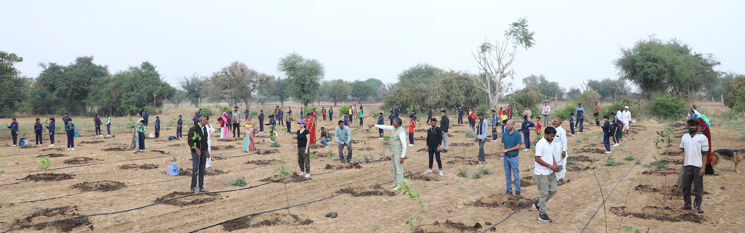
The process begins when a trained planting team arrives at the plantation site with GPS-enabled devices. They capture the exact latitude and longitude of each tree at the moment of planting. This data is synced to a secure cloud platform in real time, creating an instant, verified record.
- → Site Preparation: The team selects the tree species and prepares each planting spot carefully.
- → GPS Capture: At planting, the exact coordinates are recorded using a dedicated geo-tagging app.
- → Photo Documentation: A photo of the newly planted tree is uploaded alongside the location data.
- → Cloud Sync: All data syncs to a secure, centralised dashboard within minutes of planting.
- → Donor Access: The tree's sponsor receives a personal tracking link to follow their tree's journey.
This step-by-step process is proven to improve accountability and build lasting trust between planters and donors. However, the true value lies in the ongoing monitoring that continues well beyond the initial planting event. Our team ensures that each tree's profile is updated regularly with fresh photos and detailed health reports.
Why Is Geo-Tagging Important for Plantations? 💡
Geo-tagging brings transparency and trust to tree planting programs that were once impossible to verify remotely. Without it, donors and sponsors have no way to confirm that their trees were actually planted in the ground. Moreover, geo-tagging helps plantation managers monitor survival rates and plan effective, timely follow-up care.
According to the World Wildlife Fund (WWF), deforestation destroys approximately 10 million hectares of forest every year across the globe. Verified, geo-tagged reforestation efforts are essential to combat this alarming and ongoing loss. Therefore, technology-backed planting is no longer optional — it is a necessity for credible, impactful environmental action.
In addition, geo-tagged data helps governments and organisations meet international climate commitments with confidence. The United Nations Climate Change framework requires measurable, reportable, and verifiable environmental actions from all stakeholders. Geo-tagging provides exactly the kind of certified data trail needed to support these critical global goals.
The Technology Behind Geo-Tagging ⭐
Modern geo-tagging relies on a powerful combination of GPS satellites, mobile applications, and cloud storage systems. GPS satellites deliver location accuracy within just 2 to 5 metres — precise enough to identify individual trees in a dense plantation. Mobile apps then capture this data along with photos, timestamps, and species information in one seamless workflow.
Cloud platforms store and display all this data in interactive, user-friendly digital maps. Users can zoom into their specific tree's location and view its full growth journey over time. This is a proven, hands-on way to stay connected to your environmental impact from anywhere on the planet.
Advanced systems also integrate with satellite imagery for remote plantation health assessments. This allows independent verification of canopy cover and ecosystem recovery at a landscape scale. As a result, stakeholders can trust the data fully without needing to visit the site in person.
How Grow Billion Trees Uses GeoTag Technology ✅
At Grow Billion Trees, we provide a complete 4ft Tree Planting + 3 Years Care + GeoTag package with every single tree planted through our programs. Our team ensures each tree receives its own GPS coordinate, photo record, and digital profile at the moment of planting. We guarantee that every donor can track their tree's progress in real time, from anywhere in India or abroad.
Our experience shows that geo-tagged trees enjoy significantly higher survival and care rates compared to untracked plantations. We found that when donors can see their trees growing on a map, they feel more connected to the natural world and to the shared mission. Our partners across Mumbai, Bangalore, Delhi, Chennai, and Hyderabad have expressed how meaningful this live visibility is to their teams and stakeholders.
Our mission is grounded in Combating Climate Change Through Collective Action, and technology is central to that effort. We are working towards planting 100 crore trees across India by June 2030 — one geo-tagged tree at a time. Through our verified GeoTag system, each tree contributes to Net Zero Targets with authentic, auditable, and fully transparent data that organisations can confidently rely on.
Who Benefits from Geo-Tagged Tree Planting?
Geo-tagging benefits a wonderful range of individuals, organisations, and communities across India. Anyone can Plant a tree in your Name and receive a personal tracking link as a meaningful, lasting keepsake of their contribution. Corporate partners can use geo-tagged plantation reports to demonstrate verified, measurable progress toward their Net Zero Targets in annual ESG disclosures.
Farmers enrolled in our agroforestry programs also benefit greatly from geo-tagged tree records over time. Tracked trees on farmland can be assessed for growth, yield, and ecological value across multiple growing seasons. This data helps farmers improve sustainable land use and qualify for eco-friendly green certifications backed by real, verifiable field data.
Communities, schools, and event organisers love geo-tagged trees for birthdays, memorials, and special celebrations. A geo-tagged tree planted in memory of a loved one becomes a living, growing tribute on the earth for generations. It is a mindful, conscious way to leave a lasting, positive mark on the planet we all share together.
Geo-Tagging and Corporate Sustainability ⭐
In 2026, over 70% of major Indian corporations have made formal sustainability commitments, according to industry sustainability reports. Corporate responsibility now demands measurable, verifiable environmental impact that goes beyond pledges and promises. Geo-tagged tree planting gives sustainability teams the certified, auditable data they need for credible, trusted ESG reporting.
Grow Billion Trees partners with corporates across India to deliver scalable, geo-tagged planting programs tailored to each company's goals. We provide detailed plantation reports backed by GeoTag data to support ESG disclosures and Net Zero Target claims. Our certified approach helps companies move beyond empty commitments and demonstrate authentic, on-ground environmental action that stakeholders can see and trust.
Moreover, our Miyawaki, Mangrove, Urban Forest, and Agroforestry programs each use the same secure geo-tagging system for full consistency. This allows corporates to diversify their environmental portfolio while maintaining complete transparency across all programs. Therefore, companies can confidently report their green impact knowing that every tree is individually tracked, photographed, and verified.
Tips for Choosing a Geo-Tagged Planting Program 💡
Not all tree planting programs offer the same level of transparency, care, or long-term commitment. When choosing a geo-tagged planting program, look for these key features to ensure your contribution is real and lasting:
- ✅ Individual GPS coordinates for each tree, not just the general plantation boundary
- ✅ Photo documentation captured and uploaded at the actual time of planting
- ✅ Long-term care commitment of at least 3 years after the tree is planted
- ✅ Donor-accessible tracking dashboard with live location and growth updates
- ✅ Certified and verified reporting suitable for ESG disclosures or personal records
Grow Billion Trees meets every one of these standards with pride and dedication. Our team is happy to walk you through our transparent, hands-on planting process in as much detail as you need. We love helping people and organisations discover the full, lasting impact of every tree they plant with us.
As the United Nations Sustainable Development Goals highlight, protecting and restoring forests is essential to achieving a sustainable, thriving future for all life on Earth. Choosing a verified, geo-tagged program ensures your contribution is real, impactful, and aligned with these critical global goals.
Frequently Asked Questions
What is geo-tagging in tree plantation?
Geo-tagging in tree plantation is the process of assigning GPS coordinates to each planted tree, creating a verifiable digital identity for it. This allows donors, organisations, and governments to track and monitor tree survival over time with confidence. It makes tree planting transparent, easy to report, and deeply accountable to all stakeholders.
How accurate is geo-tagging for individual trees?
Modern GPS-based geo-tagging is accurate to within 2 to 5 metres, which is more than sufficient to identify individual trees in a plantation. This level of precision provides a reliable and secure way to verify each tree's exact planting location on a map. As technology continues to improve, accuracy will only get better over time.
Can I track my geo-tagged tree online?
Yes, absolutely. When you plant a tree with Grow Billion Trees, you receive a personal tracking page showing your tree's GPS location, planting photo, and regular growth updates. It is a great, hands-on way to stay connected to your environmental impact from anywhere in the world, at any time.
How does geo-tagging help fight climate change?
Geo-tagged trees provide verified, measurable carbon sequestration data that directly supports international climate reporting requirements. This certified data is essential for meeting commitments under global frameworks like the UN Climate Change agreements. Therefore, geo-tagging makes reforestation a credible, transparent, and measurable climate solution rather than a vague promise.
Is geo-tagging used in corporate sustainability programs?
Absolutely. Corporate sustainability teams rely on geo-tagged plantation data for ESG reporting and Net Zero Target verification. Grow Billion Trees provides certified plantation reports backed by GeoTag technology for all corporate partners across India. This ensures authentic, auditable, and trusted sustainability performance that stakeholders and regulators can rely on.
What happens to my geo-tagged tree after it is planted?
Your tree receives 3 full years of dedicated care, including watering, protection, and regular growth monitoring by our field teams. Our team updates your tree's digital profile with new photos and health reports throughout the entire care period. We ensure that your tree thrives and grows into a lasting, living contribution to the planet we all love.
Can I plant a geo-tagged tree as a gift?
Yes, and it makes a wonderful, heartfelt gift for birthdays, memorials, Women's Day, and other special occasions. You can Plant a tree in your Name or dedicate it to someone special as a lasting symbol of care. Each tree comes with a personalised certificate and a live digital tracking link to share and cherish.
How does Grow Billion Trees ensure transparency in its planting programs?
Our complete 4ft Tree Planting + 3 Years Care + GeoTag package guarantees that every tree is individually geo-tagged, photographed, and monitored from day one. We provide GPS data, photo records, and regular updates through our secure digital tracking platform accessible to every donor. Our hands-on experience and long-term commitment make us a trusted, verified partner in India's reforestation journey. Geo-tagging is a powerful tool that transforms tree planting from a simple gesture into a verified, transparent, and lasting commitment to the earth we all share. It empowers individuals, corporates, and communities to boost their environmental impact, trust the process, and connect with nature in a conscious and mindful way. Whether you are planting to celebrate a special moment, honour a memory, or improve your organisation's sustainability credentials, geo-tagged trees offer the proof and the joy of real, lasting impact. We warmly invite you to explore how Grow Billion Trees can help you make a wonderful, lasting difference for the planet and future generations. Discover our geo-tagged planting programs — from Miyawaki forests to Mangrove restoration — and take your first conscious step toward a greener, more sustainable India. Learn more at Grow Billion Trees and plant your tree today.