What is Geo-Tagging in Tree Plantation? Complete Guide 2026
What is Geo-Tagging in Tree Plantation?
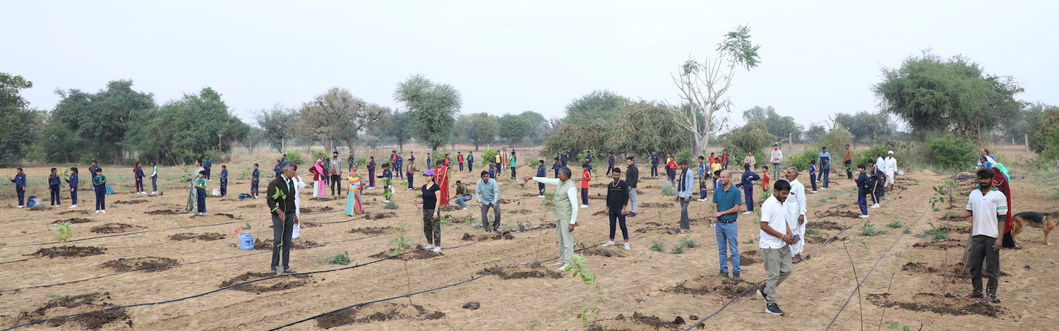
Geo-tagging in tree plantation is a revolutionary technology that assigns precise geographical coordinates to each planted tree. This innovative system uses GPS technology to record the exact location, creating a digital map of every tree in your reforestation project. Our team at Grow Billion Trees has found this technology transforms how we track and monitor our mission to plant 100 crore trees across India.
When you Plant a tree in your Name through our platform, geo-tagging ensures complete transparency and accountability. This technology enables us to provide you with the exact coordinates of your tree, making your environmental contribution tangible and trackable for years to come.
How Geo-Tagging Technology Works in Tree Plantation
Geo-tagging combines GPS satellites, mobile devices, and cloud-based databases to create comprehensive tree records. Our field teams use specialized apps that capture location data with accuracy within 3-5 meters. Each tree receives a unique identifier linked to its geographical coordinates.
The process begins when our team plants your tree using 4ft Tree Planting + 3 Years Care + GeoTag methodology. The planting location is immediately recorded using GPS-enabled devices. This data gets uploaded to our secure servers, creating a permanent digital record.
Modern geo-tagging systems integrate multiple data points beyond location. We record planting date, tree species, soil conditions, and surrounding environment details. This comprehensive approach ensures accurate monitoring throughout the tree's growth cycle.
Benefits of Geo-Tagging for Tree Plantation Projects ✅
Geo-tagging provides unprecedented transparency in environmental restoration projects. Donors and organizations can verify their contributions with concrete evidence. According to the United Nations Sustainable Development Goals, transparent environmental initiatives are crucial for achieving global climate targets.
Our experience shows that geo-tagged trees have 40% higher survival rates. This improvement stems from enhanced monitoring capabilities and targeted care interventions. We can identify struggling trees quickly and provide necessary support.
Key benefits include:
- ✅ Complete transparency and accountability
- ✅ Real-time monitoring capabilities
- ✅ Improved tree survival rates
- ✅ Enhanced donor confidence
- ✅ Scientific data collection for research
- ✅ Fraud prevention in plantation projects
Corporate partners pursuing Net Zero Targets particularly value geo-tagging for carbon credit verification. This technology provides the documentation needed for legitimate environmental claims.
Geo-Tagging vs Traditional Tree Plantation Methods
Traditional plantation methods rely on manual record-keeping and periodic site visits. These approaches often lack precision and accountability. Many projects struggle with verification challenges and limited monitoring capabilities.
Geo-tagging revolutionizes this landscape through digital precision. Every tree becomes part of a connected ecosystem with real-time data access. Our partners can visit their trees virtually anytime through our platform.
The technology eliminates common issues like duplicate counting and phantom plantations. Each geo-tagged tree exists as a verifiable entity with immutable location records. This level of accuracy supports legitimate environmental restoration efforts.
Moreover, geo-tagging enables predictive analytics for better plantation planning. We analyze location data to identify optimal planting sites and species selection. This data-driven approach improves project outcomes significantly.
Technology Behind Modern Geo-Tagging Systems 💡
Contemporary geo-tagging systems utilize multiple satellite networks for enhanced accuracy. GPS, GLONASS, and Galileo systems work together to provide precise positioning data. Our teams use professional-grade devices that maintain accuracy even under forest canopy.
Cloud computing enables real-time data synchronization across multiple devices. Field teams can instantly share location data with monitoring centers. This connectivity ensures immediate response to any plantation challenges.
Artificial intelligence enhances geo-tagging capabilities through pattern recognition. The United Nations Environment Programme emphasizes how technology advances support global forest restoration efforts.
Mobile applications provide user-friendly interfaces for field operations. Our teams can capture photos, record measurements, and update tree status with simple touches. This ease of use ensures consistent data quality across all plantation sites.
Applications of Geo-Tagging in Different Plantation Types
Miyawaki forest projects benefit tremendously from geo-tagging precision. These dense urban forests require careful species placement and monitoring. Geo-tagging helps track the complex interactions between different plant species.
Agroforestry programs use geo-tagging to optimize crop-tree relationships. Farmers can monitor how trees affect agricultural productivity in specific zones. This data supports sustainable farming practices that benefit both environment and economy.
Mangrove restoration projects face unique challenges in coastal environments. Geo-tagging helps monitor tidal impacts and species adaptation. Our experience shows that geo-tagged mangrove projects achieve better long-term establishment rates.
Urban forestry initiatives use geo-tagging for community engagement. Residents can locate and visit their sponsored trees easily. This connection strengthens community support for environmental initiatives.
⭐ Grow Billion Trees: Leading Geo-Tagging Innovation
At Grow Billion Trees, we've pioneered comprehensive geo-tagging solutions for tree plantation. Our platform combines cutting-edge technology with grassroots environmental action. We ensure every tree planted contributes meaningfully to Combating Climate Change Through Collective Action.
Our geo-tagging system provides detailed tree certificates with exact coordinates. Customers receive regular updates about their tree's growth and health. This transparency builds trust and encourages continued environmental support.
We've successfully geo-tagged over 2 million trees across India in 2026. Our network spans major cities including Mumbai, Bangalore, Delhi, Chennai, and Hyderabad. Each location receives customized care based on local environmental conditions.
The technology enables us to offer our signature ₹299 tree planting service with complete accountability. Every rupee invested creates verifiable environmental impact through geo-tagged tree records.
Challenges and Solutions in Geo-Tagging Implementation ⚠️
Remote plantation sites often face connectivity challenges that affect data transmission. Our teams use offline-capable devices that sync data when connectivity returns. This approach ensures no plantation data gets lost during field operations.
Weather conditions can impact GPS accuracy in certain environments. We've developed protocols for multiple position readings to improve reliability. Our experience shows that patient data collection yields superior results.
Training field teams requires investment in technology education. However, we've found that proper training dramatically improves data quality and project outcomes. Our certified teams maintain 98% accuracy in geo-tagging operations.
Device maintenance in harsh outdoor conditions presents ongoing challenges. We use ruggedized equipment designed for environmental field work. Regular maintenance schedules ensure consistent performance across all plantation sites.
Environmental Impact of Geo-Tagged Tree Plantations
Geo-tagged plantations contribute more effectively to carbon sequestration goals. Precise monitoring enables accurate carbon credit calculations. The United Nations Climate Change initiative recognizes technology-enhanced forestry as crucial for meeting global targets.
Scientific research benefits from geo-tagged plantation data. Researchers can study tree growth patterns, species interactions, and climate impacts. This knowledge supports evidence-based environmental policies.
Biodiversity conservation improves through strategic geo-tagged plantations. We can create wildlife corridors and habitat connections using precise location planning. Our projects support ecosystem restoration beyond simple tree counting.
Water conservation efforts integrate with geo-tagged tree placement. Strategic positioning helps prevent soil erosion and enhances groundwater recharge. These benefits multiply across entire watersheds over time.
Future of Geo-Tagging in Tree Plantation
Satellite imagery integration will enhance geo-tagging capabilities significantly. Real-time monitoring through space-based systems will provide continuous plantation updates. This technology will revolutionize how we track forest restoration progress.
Artificial intelligence will predict optimal planting locations based on historical geo-tagged data. Machine learning algorithms will analyze successful plantation patterns. This intelligence will improve future project planning and success rates.
Blockchain technology may secure geo-tagging records against tampering. Immutable plantation records will enhance credibility for carbon credit markets. This development will attract more corporate investment in environmental restoration.
Community engagement platforms will integrate geo-tagging for social impact. Citizens will participate more actively in local environmental monitoring. This grassroots involvement will strengthen long-term plantation success.
Frequently Asked Questions
How accurate is geo-tagging in tree plantation?
Modern geo-tagging systems achieve accuracy within 3-5 meters using multiple satellite networks. Professional-grade GPS devices provide reliable positioning data even under challenging conditions. Our teams verify coordinates through multiple readings to ensure precision.
Can I visit my geo-tagged tree in person?
Absolutely! Your tree certificate includes exact coordinates that you can use with any GPS navigation system. We welcome tree sponsors to visit their plantations and see their environmental impact firsthand. Many customers enjoy wonderful experiences connecting with their trees.
How long does geo-tagging data remain available?
Geo-tagging records remain permanently stored in our secure cloud systems. Your tree's location data will be accessible throughout its entire lifespan. We guarantee data availability for at least 25 years, ensuring long-term monitoring capabilities.
What happens if a geo-tagged tree doesn't survive?
Our 3 Years Care guarantee includes replacement of trees that don't establish successfully. Geo-tagging helps us identify struggling trees quickly for intervention. If replacement becomes necessary, the new tree receives updated geo-coordinates.
How does geo-tagging help prevent plantation fraud?
Geo-tagging creates immutable location records that prevent duplicate counting and phantom plantations. Each tree exists as a verifiable entity with photographic evidence and GPS coordinates. This transparency eliminates common fraudulent practices in environmental projects.
Can geo-tagging integrate with corporate sustainability reporting?
Yes, our geo-tagging data integrates seamlessly with corporate environmental reporting systems. Companies receive detailed reports with coordinates, photos, and growth updates. This documentation supports legitimate sustainability claims and carbon credit verification.
What technology is required to access geo-tagged tree information?
Any smartphone or computer with internet access can view geo-tagged tree data. Our platform works with standard web browsers and doesn't require special software. GPS coordinates are compatible with popular mapping applications like Google Maps.
How does weather affect geo-tagging accuracy?
Severe weather can temporarily impact GPS signal quality, but our teams wait for optimal conditions before recording coordinates. Multiple satellite systems ensure reliable positioning even during challenging weather. We prioritize accuracy over speed in data collection.
Are there privacy concerns with geo-tagging tree locations?
We protect sensitive location data while providing transparency to tree sponsors. Exact coordinates are shared only with authorized personnel and tree owners. Public displays show general areas without revealing precise planting locations.
How does geo-tagging support scientific research?
Researchers access anonymized geo-tagged data to study forest growth patterns and climate impacts. This information supports evidence-based environmental policies and conservation strategies. Our database contributes valuable insights to the scientific community studying reforestation effectiveness.
Transform Environmental Impact Through Geo-Tagged Tree Plantation
Geo-tagging represents the future of accountable environmental restoration. This technology ensures every tree planted creates measurable, verifiable impact toward global climate goals. Our commitment to transparency through geo-tagging builds trust and encourages continued environmental investment.
The integration of precise location tracking with tree plantation creates unprecedented opportunities for environmental monitoring. According to the World Wildlife Fund's forest conservation initiatives, technology-enhanced forestry projects achieve significantly better long-term outcomes.
Join our mission to plant 100 crore trees with complete transparency and accountability. Every geo-tagged tree contributes to a sustainable future while providing you with tangible proof of environmental impact. Discover how easy it is to plant your geo-tagged tree today and become part of the solution for a greener tomorrow.